<img height="1" width="1" style="display:none" src="https://www.facebook.com/tr?id=2068773736745421&amp;ev=PageView&amp;noscript=1">

Underwater ROVs: What Are They and How Are They Used?

Posted by Joe Baldoni on August 02, 2022

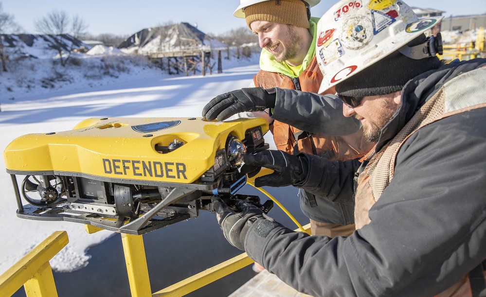
ROV stands for remotely operated vehicle. They are highly maneuverable unoccupied machines used to observe and work underwater, often in areas that are deemed too dangerous for commercial divers. ROV pilots can operate them from a nearby shore or boat.

Remotely operated vehicles are versatile tools commonly used in our industry to inspect, monitor underwater structures, and perform complex work tasks in depths divers cannot access. Although, more recreational ROVs are available with advancements in technology. These revolutionary machines are utilized by many industries to reduce costs to clients and keep divers safe in unknown or dangerous conditions.

Read More

QC-ing the QC Equipment

Posted by Dillon Hogan on April 03, 2018

All Systems Go

At Brennan, we utilize hydrographic survey systems to measure progress on all of our dredging projects. These systems typically include a positioning system, such as RTK-GPS, and a multi-beam echo-sounder. The Real Time Kinematic, Global Positioning System, or RTK-GPS, is a precise satellite navigation tool, whereas an echo-sounder is a sonar device for measuring depth. Combining the two allows us to achieve very accurate measurements on the location of the river bottom. We take the data points created during these measurements and create a 3-dimensional model using Hypack® software. By running a survey before we dredge, and then one afterward, we can create two models and compare them to one another. The difference between the two models is the total volume of in-situ yardage that we have removed. Typically, we are paid by the in-situ volume of sediment (in cubic yards) that we remove so it is very important that these measurements are extremely accurate. Therefore, establishing quality control checks on the equipment before we survey is an extremely important step in achieving accurate measurements.

Read More

How to Perform Hydrographic Surveys like a Pro

Posted by Samantha Schmitz on September 18, 2015

            Hydrographic surveys are a very effective way to map the bottom of a river, lake, or other water body.  By using some of the latest technologies a 3-dimensional model can be developed to show contours, obstacles, scour areas, and large debris.  Even in the most turbid conditions, a hydrographic survey done correctly can be very effective. 

Read More